
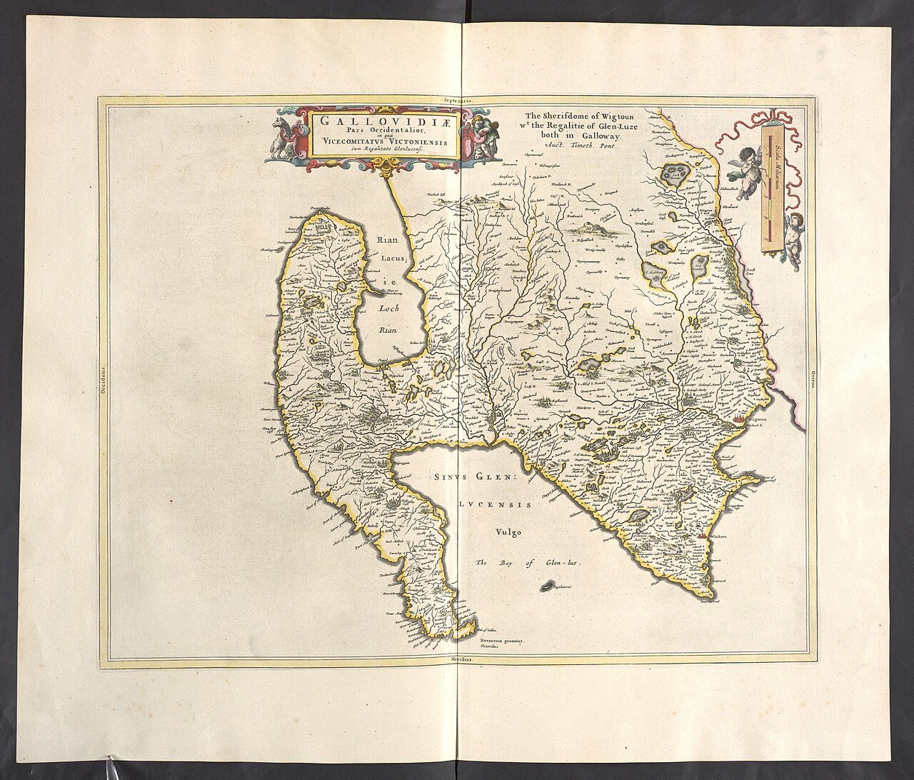
Historic maps can make an ordinary Stranraer street or stretch of shoreline more interesting. They show how a place was recorded at a particular time, sometimes revealing earlier building footprints, railway layouts or field boundaries. They are also selective documents. A missing feature may be too small for the scale, and an old road line does not establish a route you can use today. Start with one clear question rather than trying to explain the entire town.
Choose a scale that answers the question
A broad county map helps place Stranraer in relation to Loch Ryan and nearby settlements. A detailed town or large-scale Ordnance Survey sheet is better for comparing a street corner or building footprint. The National Library of Scotland's map search groups material by category and allows searches by place, county or parish.
Read the sheet information before interpreting the image. Survey, revision and publication can be different dates. Write down the relevant dates and the map series, so a later note does not turn a general 'old map' into falsely precise evidence. The map key also matters: a symbol or shaded area can have a technical meaning.
Compare from a stable reference point
Find a feature recognisable in both records, such as a long-established building or a distinctive road junction. Work outward slowly. Historic and modern mapping may align imperfectly, so a small offset in an overlay is not proof that a wall or shoreline moved. Side-by-side viewing can sometimes make the comparison easier to judge.
For a railway question, trace the relationship between track, platform and harbour rather than interpreting every thin line as a railway. For a coastal question, distinguish mapped water, foreshore and constructed edges. The map provides a lead to investigate with photographs, records or site interpretation.
Take the question outside, not the old route
On a town walk, carry a modern map for navigation and use a few saved historic details as prompts. Observe from public space and respect current barriers, private premises and road conditions. A former path may now end at a building or working site.
After the visit, label each conclusion: visible today, recorded on a named historic map, or still a possibility. This small habit prevents an interesting comparison from becoming a story stronger than its evidence. It also leaves a useful trail if you return to the question later.
A couple of practical questions
Is the oldest map always the most useful?
No. The best choice depends on scale, coverage and your question. A later detailed town plan may reveal much more about a street than an earlier map of the whole county.
Can I follow a path shown on a historic sheet?
Use current mapping, signs and access information for a journey. Historic depiction does not establish present-day access, condition or safety, even when part of the line still appears on the ground.

.jpg)
.jpg)