
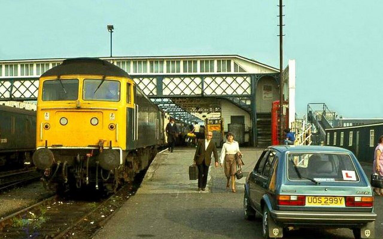
Railway history around Stranraer can become confusing when an old route, a station name and a present-day journey are treated as the same thing. Start with the harbour station's position beside the water, then use a dated map to follow the lines that once connected the town with other parts of southwest Scotland.
Follow the sequence of connections
Dalbeattie Museum records the railway between Dumfries and Castle Douglas opening in 1859, followed by the Castle Douglas–Stranraer section in 1861 and the Stranraer–Portpatrick connection in 1862. These dates describe a developing network. They explain why a map showing only the present line leaves out an important part of the region's transport story.
The museum uses the names 'Paddy Line' and 'Port Road' for the former Dumfries–Stranraer route and records its closure in 1965. Keep that closure separate from the continued existence of rail travel to Stranraer. A statement that a historic line closed does not mean the town lost every railway connection.
Look at the station as a place of interchange
The present station is identified by ScotRail as Stranraer Harbour station, off Port Rodie. Its waterside setting makes the historical relationship between rail and maritime journeys easy to consider. Look from public passenger areas, keeping clear of platform edges and any staff-only access.
Compare a dated historic photograph with the current arrangement. Notice the platform, roof, track direction and buildings before concentrating on the train. A locomotive is often the most eye-catching feature, but the infrastructure can reveal more about how people moved through the site.
Do not use an old image to decide which doorway, platform or footbridge is available now. If you want a photograph, take it from a permitted place without obstructing passengers. The railway remains a transport facility, and a heritage interest needs to fit around its daily use.
Separate research from today's journey
For historical research, write the map year and station name beside your notes. Similar names can refer to different sites or periods, while a surviving building may have acquired another purpose. Treat a promising alignment as a research lead, not as permission to walk along former railway land.
For actual travel, use ScotRail's journey planner and current station information. Check assistance, ticket collection and onward transport for your date. A harbour station's name does not establish a present train-to-ferry connection; ferry passengers must arrange travel to the correct Cairnryan terminal.
A couple of practical questions
Did the 1965 closure end all trains to Stranraer?
No. That date concerns the former Port Road discussed by Dalbeattie Museum. Stranraer still has an operating station; use current railway information for the route and timetable of your journey.
Can I walk a disused line to investigate it?
Only use routes that are presently open and permitted. Historic railway maps do not show current ownership, safe surfaces or access arrangements, and an old trackbed is not automatically a public walking route.

.jpg)
.jpg)